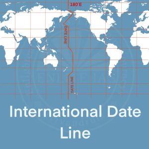
- Similarly, in going westwards, he loses 12 hours when he reaches 180°W. There is thus a total difference of 24 hours or a whole day between the two sides of the 180° meridian.
- This is the International Date Line where the date changes by exactly one day when it is crossed. A traveller crossing the dateline from east to west loses a day (because of the loss in time he has made), and while crossing the dateline from west to east he gains a day (because of the gain in time he encountered).
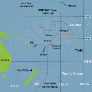
- The International Date Line in the mid-Pacific curves from the normal 180° meridian at the Bering Strait, Fiji, Tonga, and other islands to prevent confusion of day and date in some of the island groups that are cut through by the meridian.
- Reason for international dateline drawn in a zigzag manner
- The International Date Line (IDL) passes through the Pacific Ocean.
- The time difference on either side of this line is 24 hours. So, the date changes as soon as one crosses this line.
- Some groups of Islands (Polynesia, Melanesia, Micronesia) fall on either of the datelines. So if the dateline was straight, then two regions of the same Island Country or Island group would fall under different date zones. Thus to avoid any confusion of date, this line is drawn through where the sea lies and not land. Hence, the IDL is drawn in a zig-zag manner.