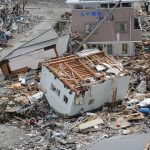
Definition
- It is type of mass wasting in which movement of rock mass or debris down the slope take place
- Example – Landslide in Kerala’s Wayanad district (June, 2024).
Landslide Vulnerability Zones of India
- Around 12.6% of the land area, excluding snow-covered areas, is prone to landslide hazards.

| Zones | Explanation |
| Very High Vulnerability Zone |
|
| High Vulnerability Zone |
|
| Moderate to Low Vulnerability Zone |
|
| Other Areas |
|
- Causes of Landslide
- Natural Causes
- Heavy rainfall
- Earthquake
- Volcanic eruption
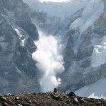
- Melting of glaciers
- Man Made Causes
- Deforestation
- Shifting cultivation
- Mining operations
- Infrastructure development

Landslide Management Cycle
- Prevention
- Modify slope geometry.
- Installation of structures such as piles and retaining walls.
- Ground reinforcement using rock bolts, steel set, etc.
- Keeping drains clean to prevent any blockage.
- Inspecting drains
- Mitigation
- Mapping of landslide zones.
- Identifying areas of rockfalls and subsidence of buildings, and cracks.
- Restriction on construction and other development activities in vulnerable regions.
- Installing early warning systems.
- Large-scale afforestation.
- Community awareness
- Response
- Restrict movement in the landslide-affected regions.
- Dissemination of information.
- Search and rescue of victims
- Provide relief and medical aid.
Government Effort to Mitigate Landslide
- Geological Survey of India
- The Geological Survey of India as a Nodal Agency is responsible for:
- Coordinating and undertaking geological studies for landslide hazard mitigation
- Carrying out landslide hazard zonation
- Monitoring landslides and avalanches
- Studying the factors responsible for sliding and suggesting precautionary as well as preventive measures. National Core Group has finalised the action plan for landslide studies with inputs from GSI and other organisations.
- The Geological Survey of India as a Nodal Agency is responsible for:
- National Landslide Risk Management Strategy
- Landslide Hazard Zonation:
- It recommends Landslide Hazard Zonation maps to be prepared at macroscale and meso levels.
- It focuses on making use of advanced state-of-the-art tools such as Unmanned Aerial Vehicle (UAV), Terrestrial Laser Scanners, and very high-resolution Earth Observation (EO) data.
- Landslide Monitoring and Early Warning System:
- Technical recommendations for developing and implementing rainfall thresholds, Numerical Weather Prediction (NWP), Automatic Rain Gauges, etc. have been included.
- Awareness Programs:
- A participatory approach has been defined so that each section of the community is involved in the awareness drive.
- Since the community is the first to confront the disaster before any aid reaches them, a mechanism of awareness is framed to involve and educate the community.
- Capacity Building and Training of Stakeholders:
- Creation of the Centre for Landslide Research Studies and Management (CLRSM) to create a techno-scientific pool of expertise in the country.
- Landslide Hazard Zonation: